Hayles Fruit Farm was a great campsite run by a very friendly lady who, I assume, was the matriach of operations, referring to 'her' cider. She kindly opened the shop so that I could buy a bottle - and it was very good. If you support locally produced food, the shop seemed large and well-stocked, so worth a proper visit; the site of Hailes Abbey (ruin) is also nearby, managed by English Heritage.
I managed to leave at 7 am crossing quickly from Gloucestershire to Worcestershire; more hills and some quite amazing villages on the way to Chipping Camden. Snowshill has a lavender farm and distillery, and the smell of the lavender growing in several great fields was amazing; it must be even more so when it's in flower.
Chipping Camden describes itself as one of the most 'beautiful tourist destinations in the UK' and I don't think they're overstating it; it really is. I imagine it must have been used as a film set for some Austen or Shakespearian thing, surely no film maker could let all those twisted chimneys, stone buildings with carved pillars and gargoyles pass. I think a relaxing weekend in a 14th century inn with exposed beams and open fires might be called for at some point...
Onwards East and over another border, back into Warwickshire and Shipston on Stour where I picked up bike route 5 (a mixture of bridleways and off-road hard path) to Banbury. Skirted the edge of Banbury around industrial estates and the train station. (National Bike Routes pick the quietest roads but not necessarily the most scenic). Crossed the M40 and was then in Northamptonshire! Although I'd only done just over 42 miles by that point (and had guessed that it would be about 100 miles from Hailes to home) it did feel like progress. But it was 1pm, so there was a long afternoon ahead.
The hills eased off somewhat and the mileage picked up from 7 miles in an hour to ten. I got into a zone, as happens when running and zipped through South Northants with barely a glance; Sulgrave, Weedon Lois, Wappenham, Abthorpe. Went around Towcester and past the racecourse onto Shutlanger (3pm, 62.7 miles) towards Stoke Bruerne. I took a photo of the signpost there, because this bit of road up to Blisworth represented an end of the loop in itself; I'd come up this road from the other direction on Day 5 heading West.
Blisworth was the proposed end for today and it was as well I was planning to continue, as 3:30 pm would otherwise have been an early stop (66 miles at that point). In the zone again, nodding to Quinton, Hackleton, Horton, then onto more familiar ground at Castle Ashby and Mears Ashby. There are some long roads around here too, and it was now 5pm, 83.5 miles down. It was starting to get painful and the average speed dropped below steady 10 mph at about this point. I'd done what was a normal day's riding, and the body was protesting at doing more. My hands were particularly sore from 13 days of either leaning on or pulling on the handlebars.
Onwards and upwards, literally now, continuing north to Little Harrowden, Orlingbury and Pytchley - a place I was only vaguely aware of as a name of one of Kettering's industrial estates, and having gone through it I'm afraid it really is that non-memorable. Over the bridge at the A43 and suddenly I was back in town, on familiar streets, with only a couple of miles to the front door. After a gloomy and dull day all day, the sun had come out, and it was good to be back. I would like to have done 100 miles (I like round figures) but wasn't going for a trip round the block to get the extra 4 miles in! Enough is enough. Job done.
Friday, 9 September 2011
Thursday, 8 September 2011
Day 13 - Hailes to home - 95 odd miles
Home. Not the flattest, not the prettiest or the most historic, nor the wettest place that I've been through... but home. Will do the full write up later. I'm a little tired - nearly 100 miles in under 12 hours, not too bad. I have pizza and the unpacking can wait.
Thank God for a safe journey.
non nobis
Thank God for a safe journey.
non nobis
Wednesday, 7 September 2011
Day 12 WernGifford to Hailes, 80 m
Another tough day, especially getting out of Wales ( morning). Saw the White Castle and followed the Offas Dyke path on and off to the Severn. Bypassed Monmouth and crossed the Severn on Redbrook footbridge into England. ( Considerably fewer occurrences of the letter 'l' on signposts!) Weather quite good, even some occasional sunshine.
Long hard haul to Coleford and Cinderford and through the Forest of Dean. Ran out of energy completely; barely moving at 3 mph. Had a Lucozade shot ( caffeine and malic acid) which helped a bit, but legs ache so much now.
Into flatter country and Cotswolds, some lovely villages. Camped at a fruit farm - and managed to buy some of their own cider. Now that's local!
Tuesday, 6 September 2011
Day 11: Gorslas to Pandy, 76.77 m
Well first I have to say that before I started out this morning, I was as close as I think I've ever come to packing it all in, ringing for rescue and just going home. I was seriously dreaming of home comforts, was fed up of the rain and another wild night didn't help. I do wonder this unusually foul weather is part of the hurricane affecting North America.
I think last night was the worst this trip, mainly down to the very high winds that pulled my little tent around in all directions, and also the rain which was extremely heavy at times - even allowing for the fact that it always sounds worse in a tent. I must have got some sleep, but it didn't feel like it, and all I could think about was tomorrow's stage, over the Black Mountain - the very name gives one pause. So I looked out at the campsite at 6:30, with the trees bent over in the wind, the flag pole waving about and the rain driving across in waves and thought: I'm going out in THAT?
It took all my resources to get packed up and on the road, but my reasoning was that it would take half a day to get to me so at least I could give it an hour or so and see how things went. I certainly wasn't prepared to stay at the campsite!
So with all waterproofs on, I went into the darkness of 7am - it really was dark, more like October than September. Saw a man walking his dog and we said hello with those ' aren't we idiots to be out in this' faces.
It was hilly again right from the off, and the roads were covered with smashed up leaves, twigs, cones and fruits. How little birds like sparrows got through a night like that, I don't know. All the streams were overflowing and the rivers thick with dirty reddish brown mud.
Took advice from Andy on the route and cut over the mountain from Trap to Pont Aber, passing the distant ruins of Carreg castle on the hill. Then more hills - tried to keep pedalling through the rain - and then a cattle grid and suddenly I was on moorland, among sheep. I like moorland and this helped lift the spirits.
Crossed the other cattle grid and was now in the Brecon Beacons National Park and in wood land. My route was on tracks, but given the conditions, I stayed on the road.
Had a few problems with my route to Brecon and ended up crossing the A40 to Trallong - another hill - and got into Brecon on the B road.
And that was the worst of it done. It had stopped raining, so I found an outside cafe where I could have lunch before pushing on.
Took bike route 8 out of town, the Taff trail, which starts by going along the Monmouthshire and Brecon canal. How good to have some flat going for once.
Hit the B4558 to Pencelli to Crickhowell. Talybont on Usk was very pretty with everything a traveller needs; shop, cash point, campsite and B&B.
Made the 8 miles to Crickhowell in very good time and then had a last bit of the Black Mountain ( over Sugar Loaf) to contend with. The steep long drags uphill were one thing, but route finding another; as usual my route had given out on the GPS, so I had to work out which way to go the old fashioned way. And Pandy proved a difficult and elusive place to get to. After the GPS ( on ' find next town' mode) ordered me to do a U turn at each end of the same bit of road I gave up and took an unmade steep rough farm track that went in the right direction, which involved a deep and muddy puddle. I think that was the first time I realised that my feet had actually managed to dry out during the course of the day.
Anyway made it, thanks be to God, and just two days left now, as I'm now on the English border. Still hoping to push on and finish on Thursday. But now Wales is done, I think the hardest bit is over.
Monday, 5 September 2011
Day 10. Pelcomb Bridge to Gorlas, 60.98 m
What a wild night last night was! It was so windy I got up at about midnight to put in extra pegs, and was convinced my bike cover was blowing away. Didn't get much sleep, especially when it rained - sounded like hail it was so loud. Must have got some sleep, as woke late and got away at 7:30 only by compressing a 1.5 hour morning routine into one hour. Taking the tent down ( it was still windy) was an interesting procedure, rather like flying a very unwieldy kite at one point.
First morning riding east with the sun in my eyes, and there was a sun; a bit watery, but there. Hoped it would continue.
Crossed the main road to Camrose and through lots of tiny places on very minor and very quiet roads. The wind dropped though the sky was still interesting, so it was a lovely morning.
The first rain shower came at about 25 mile mark but soon cleared; had a few like that.
Got to St Clears for lunch and also my first shop of the day, so stocked up on Lucozade. Found a charity shop to hand a book in and replace it, and sat by a wooden carving, nearly life size, of the Rebecca Riots, where men wore dresses and blacked their faces and destroyed the toll- gates. Had my lunch there in the sun.
When I left, did up my jacket and found I couldn't. The zip has completely gone on it. Tried taping it with duct tape ( such a good look, expect to see it in all next year's collections) but the tape wouldn't stick, though it did keep catching my hair.
This was annoying; I could hardly cycle in the rain trying to hold my jacket together. Took bike route into Camarthenn, found a Field & Trek and bought a lightweight running jacket. It swamps me, but can go over my other one.
Camarthen is a big place with some decent shops but there was nothing else I wanted - except to try to leave, which wasn't easy. Found the right route and was glad to be out of the city.
Cloudy and dull from then on. Some steepish hills, but managed to keep cycling up most of them. Made good time to campsite by 5:30.
Looks like a really tough day tomorrow over the Black Mountains but then should be out of Wales and things should be easier. I think the forecast for tomorrow is also not good, and in fact the rain has set in now.
Made it!
This is as close as I get to St Davids Head - if the bike can't go there, neither will I. Just a week since Lowestoft. Amazing. But then as some joker said, if you're going to take up cross county skiing, start with a small country...

Day 9: Tufton to Pelcomb Bridge, 48.28m
Strange how soon what is taken for granted becomes commonplace; a bed, electricity; warmth. It's been lovely. Had a cooked breakfast and still managed to get away just after 7 am. The sun was up and there was an inversion in the valley; it was full of mist down there but clear where I was. Neville predicted it would burn off later.
Set off and it was cold! Not complaining as it was dry, but very chilly. It was such a good start to the day, leaving a lovely place and people like that. Those I met on the road to say ' good morning' were not so friendly. Most often, all I got by way of a response was a level stare. Was it because I was female, a cyclist, English/ outsider, or do folk not say hello to each other here?
Lots of dairy farming here. Stopped to watch a herd taken from parlour to field, was overtaken by a milk tanker, and a few miles out of St Davids, rode carefully on a road where it was clear that cattle had recently passed. Down the road saw said cattle ( including a very young calf) and the farmer tying up the gate with string. Since his vehicle completely blocked the narrow road, I stopped. No rush, I said as he dashed back. Late for church, he said Interesting.
A mile or so further on, saw lots of cars parked by the side of the road, and then heard a bell start to ring. I asked a lady walking behind me if a service was about to start - it was 9:30 - and would I be welcome? So it was that in Wales, hot- bed of Methodism, I ended up going to a C of E ( Wales) service.
The church was lovely; small, plain, white, decorated with flowers and the sun streaming in over the table. I had my shell jacket, so didn't look too violently fluorescent.
Turned out it was a special service as their vicar was moving to a new parish, but I was still made welcome ( and even managed to cope with communion!).
It was still sunny and warm; the mist had indeed burned off. It was good to feel the sun on my back and to see my shadow in front of me - for the last day, as if there is any sun from now on, my shadow will be behind me!
The ' if' regarding sunshine...
Got to St Davids and went to White sands Bay, which is the closest to St Davids Head that you can go with a bike. Looked at the sea, full of surfers today as the wind was up, had my pic taken by a kind German tourist, and felt - well rather flat actually. That's part of the problem with arbitrary points. There is no signpost to say ' you've done it! Thus far and no further'. It didn't help that it was now starting to rain.
Visited St Justinians and then went into St Davids. A wet Sunday afternoon does not do any town any favours. Looked for somewhere to change my book as I've read both my disposable novels, but no luck. Stopped for ale and cake by way of celebration, for a given value of ' celebration'. And then took bike route 4 out of town, in the pouring rain.
I mentally apologised to Jean as all the gear that had dripped and dried on her Rayburn soaked through again. And I have to say I was annoyed that the wind was still in my face - and with a steep downhill, the rain really stings. Kept a line of song going: Soon enough/ Soon enough/ This will all be a memory...
Went past Newgale and its campsite which I noticed was heavily puddled, yet there were tents up. Not too wet there, then.
The surf was really rolling now and there were lots of people out, windsurfing and also surfing with kites. I bet they got some speed up.
Through Nolton and on to Pelcomb Bridge which has campsite with pub ( note the order of priority). £10 isn't cheapest but I got a decent dinner and a head start on tomorrow. Really want to push on and get home now.
By the way, it did stop raining!
Saturday, 3 September 2011
Day 8: Cilycwm to Tufton, 67.8 miles
Woke early, much rested, packed as quietly as possible and was on road at 6:30. Slightly concerned to hear very faint noise of moisture pattering on the tent, but it was just a thin bit of cloud.
Set off to grapple with the hills again, much the same as yesterday only with slightly more energy. Still walking up most of them though! One bit was just constant up and down so to stay cycling I was changing gears every few seconds. Using the granny ring most of the time now. ( This is the smallest ring on the triple and best for getting up steep hills ( albeit very slowly - did you know it's possible to cycle at less than 3mph?) but I prefer Toria's explanation of a granny ring as a group of old ladies that help me up hills. I like the idea of octegenarian domestiques!J.
The mist got a bit thicker, more of a mizzle, but in essence I was still only in a cloud. And gradually it got wetter and wetter until it could be said to be raining, and then having got the hang of it, it set to raining in earnest.
I'm afraid that nearly all the villages I went through looked the same, and even thought I'd gone wrong and ended back at a previous one at one point. Will add the place names later, it's not easy on this. Did go into Llandysul for food as wasn't sure of finding a shop further on. Found a Nisa and got a hot pork chop, chicken leg and cheese and onion pasty for lunch. And more Welshcakes! They never last long. Had most of it there in the car park. Never ceases to amaze me, the hunger that cycling generates. Unfortunately being hungry is not always synonymous with wanting to eat.
Up more hills, through more Forestry Commission woodland, noticed first rhododendrons then heather and gorse. Then a surprise on the way to Cymych found myself going over open moorland. Quite different and so sudden. Just like being on the Pennine Way with a ribbon of road stretching up the hill. Bleak and desolate ( and wet) but I liked it.
Went through Felindre so must have gone up Allt Hiraeth ( homesick hill). Was thinking rather longingly of being dry... And warm... And of coffee.
Had some interesting features in my notes to look out for including standing stones and burial chambers, but the only standing stone I saw was a memorial to a local poet. Interesting landscape there - this on the road to Rosebush - large rocks everywhere, some moss covered, the sheep cropped grass and some gorse, and this memorial. ( Apparently there is a fantastic view from there on a good day, of Snowdon in the north and the Wicklow mountains in Ireland to the west. But this was not a good day.)
A long haul up an increasingly foggy road and * finally* got to Rosebush which has been the focus of my attention for two or three days now. Got to the campsite. It had a shop! things were looking up.
And then they were't. Sorry, said the chap, we haven't had tents for a few weeks, only caravans on the hard standing. Too wet, do you see?
Ah. So where can I go?
There might be, it appeared, a couple of campsites on the Fishguard road. Sorry. Bye.
I didn't want to go to Fishguard. Nothing personal but it wasn't on my route and I'd already done over 60 miles, it was still raining and the fog was getting thicker. But clearly I had to move so it might as well be in that direction. Something would come up. If all else failed I would have to wild camp.
Then I saw a sign for a B&B, and took no persuading to follow it. To not have to put the tent up in the rain, to dry out, a hot shower ( my legs were almost black with road dirt) - real fluffy towels, a bed... And it was all as good as it sounds. I am a guest of Jean and Neville Llewellyn of Golwyg-y-Fro in Tufton. I don't know if I would have given me the welcome they did and it's a lot to ask, taking in a really soggy cyclist. Jean washed my gear, stuffed my shoes with paper, more or less escorted me directly to the shower room and made me a huge tea. What can you say but ' wow'. It was just what I needed. It's still raining, but the forecast isn't too bad for tomorrow, I've done 616 miles so far and apparently it's only 17 more to St Davids. Its all good.
Day 7: Hay on Wye to Cilycwm. 47.39 miles
Left Hay at 7am, taking the Brecon road, which would have pleased the campsite manager. When I told him my planned route he assured me that the quickest way was the A road to Brecon and straight on to St Davids. It was too difficult to explain that the journey is the experience and St Davids only an arbitrary point to aim for, so I said something about looking at the map and ended the conversation. (I was falling over tired and just wanted to get the tent up and dinner on).
This morning's ride seemed to prove my point, if only to myself. There were pleasant lanes, the slate softened by moss and bracken. The first bike path was an old railway line, now a minor road, and I stopped at Ellwood station ( now a cafe) for a snack and to take a jacket off. Chilly morning and it couldn't seem to decide whether to burn the mist off for another hot day, or rain.
Very tired though and found every hill hard going. This was becoming more of a walking holiday than a cycling one. Still ahead of tomorrow, but there was no way I could do nearly 100 miles to get to Rosebush. Decided to find one in between, have a half rest day today and easier day tomorrow; will still aim for Rosebush but it will be 50 odd miles instead of 70.
Found a site marked on the map so headed up road and came across this one, an unmarked C&C right close to my route. Lovely long grass, very peaceful ( all I can hear are sheep and birds) £3.
Picked up some food in Builth and have my book. It's sunny and the tent drying nicely.
I've been trying to send this a few times but it keeps failing, so if you don't get it until tomorrow, that's why.
Thursday, 1 September 2011
Comberton to Hay on Wye 83.9 miles
Long hard day. Forgive notes, will fill out later.
Cold am - suddenly Sept! Saw balloon, good sign. Mist over river. Lovely golden morning. Photos and shopping in Petshore then small roads to Malvern. Hard going. Av speed never double figs. Past show ground and steep zigzag uphill. Like approaching a wall. Tough. Not much flatter other side. Through Herefordshire. Red earth, apples, hops. Decided to push on to Hay but long hard uphill to get here. Desperately need a shower, very hot day. Eagles over Hay Bluff? Not kites and noisy. Pic of Hay clock.


Wednesday, 31 August 2011
Day 5: Emberton to Gt Comberton 83.42 miles
Emberton turned out to be the campsite from hell. Was placed directly opposite a huge party of children with accompanying raucous women, all of whom seemed incapable of talking to each other in anything less than a shout. They're only kids, I thought grimly. They'll go to bed soon. They didn't. But when they did, the adults sat up to continue the party. One woman in particular had a very loud laugh and seemed to find a great deal to amuse her. At about 2:10 am I asked them ( more politely than I felt) to keep the noise down. At 3am they settled down.
So after about 5 hours of broken sleep I was not a happy person in the morning. Packed up ( noisily I'm afraid) and set off at 6:45, determined to shake the dust off my wheels.
Dull and cloudy again but saw a hot air balloon first thing which took as good sign, since they hate the wind more than I do.
Through Olney and Salcey Forest to Stoke Bruerne and up to Blisworth. This is a bit of road that I should do again at the end of the trek only turning east for home then instead of west.
Through the stone built villages of South Northants until saw some ' stop HS2' signs and I was in my third county of the day at Wormleighton in Warwickshire.
Country getting very hilly now. Got over 30 mph on four different hills today, so you can just imagine the climbs up the other side.
Stopped off at Burton Dussett country park as was in hope of coffee and large slab of cake. Alas no cafe, but loos, and interesting view. Was a quarry site, now somewhere to picnic, cycle and walk. Nice.
Had crossed M1 earlier, now crossed M40 towards Wellesbourne. A farmer I worked for once kept his dry ( Jersey) cows there, and my memories of the place were Dylan Thomas like; hay meadows, golden light, green lanes, heck probably even a swallow thronged loft or two. But Wellesbourne is a suburban little town with traffic hurrying through to Stratford, though Im sure my lane and that meadow are there, somewhere.
Went to Stratford via Loxeley to avoid the busy B road. Nice to see Stratford again. Feel I'm getting somewhere now. Had a brie and cranberry baguette with coffee and did a little shopping; one of my gas canisters was playing up this morning so got a spare, and also a bottle opener.
Was due to camp here but far too early, so started on tomorrow's route through Bidford- on- Avon and Harrington to Wyre Piddle and footpath to Pershore. Now in Worcestershire, fourth county of the day. Also on third river, having left the Ouse for the Nene and now the Avon.
Prrshore looks worthy of a longer visit but all I could fit in was the library ( to find campsite) and shop for food. Can't believe I can't get a bottle of Wyre Piddle ale though!
Excellent campsite at Great Comberton golf course. Whole field to myself - ah the peace! And campsite fee refunded to Cynthia Spencer charity ( thank you!) also got another donation in the clubhouse bar and promise of a third. You could say it's all going very well.

Tuesday, 30 August 2011
Day 4: Littleport to Emberton - 72 miles
Cloudy again. At least tent was dry to pack. Some sunshine in the morning which made going pleasant. Less wind too.
Little Downham very pleasant. Strange how different the villages are here, to those very austere and lonely places just a few miles north. There is an Anglican- Methodist church here; interesting that they seem to have kept both sites!
Bank holiday over, farm work being done, mostly cultivation but still some harvest to be got in. So on one side is ripe wheat and on the other, next year's crop greening through.
Had a bit of deja vu at Coveney ( went through there on day one). Back through Sutton to Earith and alongside the Hundred Foot Drain, another terribly long straight road. Found this was Huntingdon shire, and have to think it rather dull...
Crossed A1M at 37 miles, doing good time, but went astray at Alconbury ( too many of them ) so had to go through Woolley and Barham. Some rolling countryside more; managed 36mph on downhill to Spaldwick. Crossed A14 and went on to Kimbolton for lunch. Stopped at Olivers and had the most appreciated jacket spud ever and a nice long break with book and coffee.
Came out to unlock bike, only to find I couldn't. Fiddled with it for ages before admitting I was going to need help with this challenge. Went back to Olivers to the shop area and asked to borrow a Yellow Pages. After a minute the girl asked what was up. Explained problem and she immediately nominated her boss to fix it. He could not have been more helpful or more kind. He didn't have any tools but managed to get hold of some bolt cutters and after a few mins, my bike was free. Couldn't thank him enough! Bought new lock from hardware shop and off I went, chuffed by the kindness of strangers.
Through Pertenhall to Swineshead and Riseley. Passed the kennels at Sharnbrook - Rushden just 5 miles up the road. Hello Mum and Dad.
Day got more and more grey, quite depressing; also think I'm tired. Through Odell, Harrold, Carlton et al to Emberton. Got a pitch at the country park which takes the biscuit for the most ludicrously over priced pitch fee ever at £21. But too tired to find an alternative. Short day tomorrow to Stratford.
Monday, 29 August 2011
Day 3: Gisleham to Littleport - 87 miles
Long hard day. Everything hurts. Sore face, stiff neck and shoulders, backache, knee ache and just lets say that I'm sitting on the most padded chair in the pub.
The main reason for all this discomfort is due to the strong head wind that I had to battle against all day. Perhaps the only reason for the excellent progress in days 1 and 2 was because the wind was behind me and I never realised!
Gisleham ( pronounced Gizlam) was basic but good campsite. Got chatting to my tent neighbour this morning and found that she really was my neighbour - she lives a few streets away from me in Kettering!
Left at 7 am with the sun behind me. Found I had to be a bit more careful with route finding with GPS screen problem but it is still usable. Main problem is that if you manually toggle - necessary now - it ceases to follow automatically. I like to think that the unit gets in a huff that I'm trying to take over.
Went wrong a couple of times, mostly a case of taking the wrong turning. Worst case was at Harleston where went up a 12% hill ( well walking is a good chance to graze on blackberries) only to find myself on wrong road, but in right direction. Kept going as thought I could rejoin my route ahead ... Only to look down and see the B road passing under the road whereat I was... One illegal left turn later ( well it was onto a bike route so I'm sure ' no left turn‘ didn't mean me) a bit of skirting round and I was back.
But it was hard. Managed 11 miles in the first hour, but it dropped off after that to less than ten. The wind was constant and strong; this wasn't a gentle breeze. This was tough and unrelenting.
Used some ' quiet lanes' one of which brought me to the ruined church of Tivertshall St Mary, said to have been founded before the Conquest.
At Banham passed turn off for the zoo and stocked up on snacks in the Post Office, including a cream cake. Rejoined yesterday's route at Qidenham and for first time noticed signpost to the Carmelite Monastery ( used to be the Hall). Back past the pigs ( now awake), the Peddars at Witsend Farm, the MOD base. Passed a cyclist on a break; Team Astana gear, Bianchi bike. He caught me up of course: said he'd just cycled the Alpe d'Heuz in training for a long sportive. We were suitably impressed with each other's challenges, but I couldn't keep up for long and off he went.
The distillery was open and I was tempted to pull into the cafe, but the clouds were black and heavy, so decided to keep trying to out run the rain ( managed too).
Bike route into the forest and actually stopped for a long lunch break. Next bit was harder as cycle track was actually sand, almost impossible to stay upright - so walked, not much easier. Long road through the forest.
Cycled out to Hockwold and on to Feltwell, and then the latest challenge. The GPS route just stopped. I knew I'd planned it to the end, but it must have been too big to handle. So it cut the end off. Still I could use it to find the next village - and this showed how amorphous the border is here, between Cambs, Norfolk and Suffolk. Signposted to Southery along what has to be the longest drove road in England and the most dull - and into that incessant head wind. Seemed never ending but finally made it there and to Ten Mile Bank. There, the River Great Ouse ( picture) is far higher than the surrounding countryside, and the bank keeps it there. Another long stretch to Littleport, and luxury, campsite with endless hot water and best of all, not moving. Dinner at the Swan, just up the road.


Sunday, 28 August 2011
Day 2 Brandon to Gisleham - 71.17 miles
Another day of good progress. 71.17 miles, 6 hours 12 cycling time. Left campsite at 7:20 when the only other living thing I saw was a munctjac running through the beer garden. Clear morning ( and wet tent).
First stage was through Thetford Forest which was just lovely. Sun dappled trees, birdsong, no traffic - marvellous. Through Santon Downham, a long village with houses dotted along the forest road. Nice houses that blended in with the landscape. Houses in Fenland seem to favour function over form and are as square as if built from lego, plonked at the edges of the vast empty fields. Houses here use a lot of flint. Churches too.
Through East Wretham, its military camp and many danger areas ( firing ranges). No wild camping here!
Larling then Harling which has a whisky distillery - St Georges. Seem to remember an item on the news a while back about English whisky, must be that, so its quite new.
Went through lots of tiny villages, often just a farm and a few houses. A long way to go for your shopping, in any direction, but a beautiful and peaceful place. Saw herds of outdoor pigs dozing, and crossed the Peddars Way, which walked a few years ago. Managed 11 miles in each hour for first four hours, which is incredibly good for me. Stopped for something to eat at 40 miles - not yet 11 am. Chatted to a dog walker on the bridle way.
Beccles was the biggest place; managed to take the wrong road out and had to turn round.
Stopped at St Andrews church in Mutford as a sign said it was open, which is rare. Lovely inside, white and simple and peaceful. Turned to go and saw a kettle with coffee and polystyrene cups, and an invitation to make a drink. I was getting tired, so a coffee was just there thing. How kind of them. Signed visitors book and a lady came in - seen bike outside. I admired the font and she pointed out the chisel marks where Cromwell's men had cut off the decorative features. Some of the supporting lions had also been literally de- faced.
Felt better for the stop and was soon at outskirts of Lowestoft. Saw bike route and took it - can't believe I missed it, planning. Wide, well signposted and off the A road. 10/10. Soon saw the famous wind turbine and wandered through town to Ness Point.
Propped bike up for photo. Stepped back. Wind gusted, over went bike. And the GPS took the brunt of it.
Could be worse. Have lost about a quarter of the visible screen. Still also have printed maps and directions. Will see how things go over next day or so. Accidents happen!
Had fish and chips for late lunch and headed out to campsite, finishing day at 4pm. Could get used to these early finishes! Heading to Littleport, north of Ely, tomorrow.
Pics of Ness Point and sculpture in town.
Saturday, 27 August 2011
Day 1: Home to Brandon - 81.48 miles
Summary: 81.48 miles, 6 hours 56 mins cycling time, 8 3/4 hours actual time, max speed 34 mph, finishing average speed 12 mph (not the average over the whole day but a good guide as to progress).
Had just five hours sleep due to lots of last minute stuff including storing music on the i-pod, which took far too long. More last minute jobs in morning then Andy and Alfie came round to see me off, hence getting a picture with me in it.

Left at 7am. Two miles up the road had to replace GPS batteries. Also experienced my first hill, which was testing. Forgot just how heavy a fully laden bike is and all roads out of Kettering are uphill.
Weather not bad; grey and cloudy but dry.
So through Warkton to Slipton and took track through the Drayton estate ( no cycling - had to walk).
 Past the elaborately crenellated House (picture left) to Lowick and its church with many steeples. Thorpe Waterville and track to Clopton, Thurning, Luddington. First wrong turn at Clopton. Making good time though, nearly 20 miles by 9am. Lots of red kites about, hunting over the stubbles.
On towards Gt Gidding and Cambs. Lots of very large fields. Crossed the A1M at Holme and saw a light aircraft, later a sign to Peterborough business airport.
Ramsey, small an d pretty. My route notes say this at sea level; can well believe it as making very good time. Stopped at level crossing for train to pass and on other side suddenly was in Fenland. Thought a farm track had been tarred; it was a ploughed headland, the soil black peat, black as treacle. Amazing the sudden change.
Roads long and dead straight, and everywhere pancake flat. On drove roads now. Long Drove earns its name!
 d pretty. My route notes say this at sea level; can well believe it as making very good time. Stopped at level crossing for train to pass and on other side suddenly was in Fenland. Thought a farm track had been tarred; it was a ploughed headland, the soil black peat, black as treacle. Amazing the sudden change.
Roads long and dead straight, and everywhere pancake flat. On drove roads now. Long Drove earns its name!
Ramsey St Marys. Town! S hops! People! Has a ruined Abbey, now National Trust owned. From what's left can see it was beautiful once. (picture left).
 hops! People! Has a ruined Abbey, now National Trust owned. From what's left can see it was beautiful once. (picture left).
 Farm tracks across Gaunt Fen and Pickle Fen. Very rough, had to walk, but sun out and very pleasant. Felt I was slodging for first time. Fen slodgers describe people that lived here when it was all still flooded. Feel it is a verb we should resurrect. I slodge, thou slodgest, he slodges, we slodge...
Bike and self cove
 red in black peat, hit road to Ferry Hill and Sutton. Very warm now, then spot of rain; put jacket on and sun came back out. Picture of Delph river nr Sutton.
The route plan mentioned a place called Jerusalem but didn't see it. Shame, as hoping to go to Bethlehem ( in Wales). At Coveney saw sign for Ely, just 4.5 miles and even more amazing, could see the cathedral on the horizon from there. It's that flat. Got into Ely at 1pm, incredibly did nearly 60 miles in just 6 hours. Couldn't believe good rate of progress.
Went to Cathedral for a pic, attached. Went round it about a year ago, took nearly all day. Today a wedding party was having photos on the green.

Went to Cathedral for a pic, attached. Went round it about a year ago, took nearly all day. Today a wedding party was having photos on the green.

There was a European market in town, lovely atmosphere. Found outside cafe for luch. Nice to just sit and watch world go by.
More level crossings, to Prickwillow, and then a sign announcing Burnt Feb, Suffolk. And suddenly the scenery changed again. Fields were smaller. Different crops - Fenland is wheat, potatoes, onions; here was kale and maize for silage. And lots more trees. You don't appreciate trees until you haven't seen any for miles.
More level crossings, to Prickwillow, and then a sign announcing Burnt Feb, Suffolk. And suddenly the scenery changed again. Fields were smaller. Different crops - Fenland is wheat, potatoes, onions; here was kale and maize for silage. And lots more trees. You don't appreciate trees until you haven't seen any for miles.
Lakenhea
 th, pretty village. Woodland fenced off. MOD?
Brandon a large town. Found the Ram Hotel which does camping (£4) and the local ale, Rusty Bucket. Can't believe did 80 miles before 4pm. I like flat countryside.


Friday, 26 August 2011
Thanks...

To all my colleagues at Hewitsons for the support and encouragement, which is much appreciated. See you in two weeks!
This is also a practice run for blogging from the phone, so I attach a picture of the gear I've got to pack ( and carry).
Nearly ready for the off
It seems that work didn't want me to go without having a picture taken first - sorry it's so posey...
The caption on the T-shirt reads 'Yes I bike like a Girl. Try to keep up'.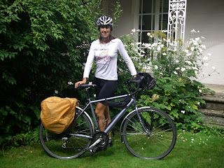
The caption on the T-shirt reads 'Yes I bike like a Girl. Try to keep up'.

Wednesday, 24 August 2011
Bike work takes longer than you think
Funny how some jobs that should take ages don't, yet a potentially quick job such as sorting the baggage for the bike managed to take all evening. At least what needs to be attached to the bike is attached and what isn't is goiing to get left.
The food shopping is done (not that it took long; I don't want to carry too much). Much of it comprises the staples of pepperami, individual portions of cheese, fun size chocolate bars and Lucozade. I was also glad to find the batteries I wanted, though aghast at the price. Lithium AAs don't come cheap but are worth it for the gps unit. Normal batteries struggle to last out one day; a set of these will last for about three days. And at £2 per battery (yes that's right) it's as well I don't need too many of them.
Piles of stuff are starting to gather around tbe house; spare clothes in one corner, camping gear in another; a pile of electronics on a table, food in the kitchen. i was a bit concerned that I had no idea where my camera was and indeed couldn't recall even having seeing it for several months, but managed to locate it amongst my triathlon gear (swimming drawer). There might be some logic there but I'm too tired to think what.
Back to the final stage of mapping tomorrow and packing on Friday. It's all going very well. At this rate I might even manage to leave on time.
Tuesday, 23 August 2011
To Do List
Finish mapping and add up projected mileage - done
Print daily route guides with campsite details to put with maps - done
Cut up paper maps and laminate - done
Find camera, batteries, charger and charge batteries done
Fit kickstand, panniers, front bag etc to bike and try to sort gears out (not quite done on the bike service...) - done
Get camping gear & clothes together; pack done
Check bike toolkit done
Do food shopping for camping food/snacks done
Sort Latitude app to show location done
Get some playlists and podcasts on i-pod
Monday, 22 August 2011
Wasted evening
So, came home determined to plan two days in one evening, sat down and planned a route along bike route 4 (through Milford Haven to Carmarthen) and then decided it was too out of the way, with too many large towns and too much coast road (which means a lot of ups and downs).
At any rate, I've a day's cycle route that I don't think I want to use this time round though it looks a very interesting route with lots of castles and other antiquities to see. But steep.
So back to square one. The re-planned route goes over the Black Mountains, but I've tried to avoid roads with more than one chevron in any direction (I might get through my new brack blocks). I've now made it as far as Offa's Dyke on planning, with three more days to plan to get me home - which I think should be possible (though I hope the offer of car rescue is still there if I do get stuck!) Given that it takes about 5 hours to plan each stage, it's not going to be done very soon, but it's getting there.
Sunday, 21 August 2011
A tribute
The death of someone you have known is always a shock and on Saturday, I came into such sad news.
Ron Espin was a leader with the Boys Brigade at my home church in Rushden, including at the Girls and Boys Brigades' summer camp (I'll never forget his rendition of 'eating people is wrong') and also more importantly from the point of view of this blog, with the Duke of Edinburgh's Award - Expedition section. Ron was part of the team of leaders that got me and my friends through, booking the campsites, driving us up and down the country, being there at checkpoints and generally chivvying us along, usually with a liberal dose of very dry humour.
These past couple of days, when I have sat down to planning, to drawing maps and putting together kit lists and food plans, I've been thinking back to the first time I did all this, over 20 years ago, for my Bronze, Silver and Gold awards, all completed successfully - thanks to the leaders such as him that put the time and effort into helping us all.
Thanks Ron.
Big country
The initial mapping is now about 2/3rds complete; from home to the start to the end point and starting on the return journey.
Started sticking the road maps together to get the big picture; it's a long bit of paper. Looked at it from the reasonably flat bits of home to the emptiness of the fens, the close-packed villages of Suffolk and Lowestoft with its yellow stripe of sand; back again, squeezing between the ugly blobs of cities (in particular the sprawling mass of Birmingham)to the green patches that are the mountains and National Parks of Wales, to flatter country again and less densely populated areas, and another yellow bit of sand at St David's.
Feels a bit hubristic actually. Well, see how it goes.
Friday, 19 August 2011
Lowestoft Ness
I believe I could spend longer poring over maps and routes than actually cycling it. Perhaps that's half the fun! The bit that exercised the route planning muscles most was getting into Lowestoft and avoiding busy A-roads. I was delighted to see (using Google aerial maps) that two of the largest roundabouts have cycle route cut-throughs and one a cycle lane alongside it. It's so good when planners get it right.
I thought they went in for some dead straight roads in Scotland (they do!) but you can't beat the twin B-roads that run from Pakefield right into Lowestoft and deviate neither to the right nor to the left. The Romans would have been proud of them. Fortunately, Google maps showed that I need neither of them. A road runs down to the promenade which runs for miles along the wide sandy beach, all the way up to Lowestoft town. That will do nicely (wind permitting).
Once in Lowestoft, it's a case of negotiating some pretty industrial looking areas (it's a working port) to get to the Ness, which is sandwiched between a gas storage tank and 'Gulliver' the largest wind turbine in the UK (and the only commercial turbine in Suffolk!) Ness Point has its own website - http://www.ness-point.co.uk/
and seems to be attempting to make something of tourism, but hasn't yet. Nevertheless, it's the official start point for me.
Tuesday, 16 August 2011
Planning
The planning continues, albeit with a few hiccups. I've struggled to get gpx files out of bikeroutetoaster.com before, so didn't even go there this time. I was recommended wheresthepath.com but unfortunately every time I logged in the site had exceeded the allowed daily downloads of map tiles (it's restricted by the OS - for copyright reasons I imagine). A bit of searching turned up a site that was vaguely familiar; maptogps.com, and finally, this worked. I plotted the route for day 1 from home to the first campsite, a distance of about 78 miles and then managed to download the route to my Garmin gps unit. And it seems to work! That's the good news. The bad news is that I seem to have lost the route from my pc - it's not saved anywhere that I can find - so I can't edit it or even check it to draw on my paper map. But that's a minor niggle; I've got the main towns and villages noted and it *should* be logical. For the next ones I'll plot the route as I go to avoid the risk of losing them too.
As for the hardware, I took the Dawes to Halfords for a service the other day; walking out holding my bike helmet was rather like going into the vets with a dog and coming out with just the lead. I didn't want to have to hand my bike over but simply don't have time to do it. And let's face it, it's done over 7,000 miles from new and no doubt deserves a bit of TLC.
It was a revelation cycling to work and back on my road bike; downhill wasn't any faster, which was interesting but the uphills were a breeze; how wonderful to waft up hills with so little effort.
The other problem with turning in the Dawes is what's in it; I found the Garmin unit with no problems but it needs two AA batteries - and where are my spare batteries? In my panniers of course, spares for the bike lights... Luckily found a pair with a bit of life left in them, which will do to get the route onto the Garmin. I've only ten days left to finalise the planning and packing and of the two weekend days left, I've a wedding to attend on Saturday (which am looking forward to very much). Time is, as ever, tight.
The packing will hopefully not take too long and the charging pack for phone and ipod is done already; the Portapow (a USB recharging pack) arrived in the post and has already charged up the phone successfully. This time I've packed the relevant leads as I managed to forget to pack a very important USB lead on my last trip, necessitating an unplanned detour to a local PC World.
Friday, 12 August 2011
Planning progress
With just two weeks to go, some frantic map planning has been going on - some of it extremely detailed, some very rough. Strangely I found the first three or four days the most tricky. Heading from home to the start and back west again, I wanted to go out and come back a different way, and ended up going either too far north (Swaffham) or too far south, and settled in the end for a 'third way' with slightly different roads but still taking in Ely.
Kettering really is in the centre of the fat bit of the country, and I found with a slight degree of horror that one planned route would take me along roads that are on my daily commute to Northampton, something I'm very keen to avoid on holiday. So I planned a southerly-ish route from Ely to Olney, avoiding well-known (one might say worn-out) routes and instead heading quickly to Bedfordshire and roads that I first cycled as a youngster, probably on my first Dawes bicycle. There is a campsite at Emberton and then it's into some scenic countryside heading to Stratford for the end of day 5. From there across the Malverns (the scenery starts getting more and more lumpy from now on) into Wales and the Brecons, hopefully arriving at St David's on day 9.
I've seen St David's (it's very nice) so don't see much reason to hang around particularly as I seem to get there after just 30-odd miles of that day's cycling, so the plan is to start heading back straight away. Coming slightly south I can get to Monmouth and come up through Oxfordshire to get home on day 14. The total estimated distance is 840 miles.
This is a very rough back-of-the-envelope distance but I did just want to see if it might be possible to go from home to home, and it looks as if the idea is a goer. I've also found most campsites to aim for (often the limiting factor of a day's ride). Now to start cutting up the road atlases and drawing the route on them, and setting up the Garmin gps. For some reason I can't seem to get routes to gpx on bikeroutetoaster.com, which is my favourite planning website, so will try another that has been recommended - wheresthepath.com. I think this site is better as it uses OS maps, but unfortunately there's a limit on the maps that can be downloaded per day and at night I've sometimes been unable to access it.
It shouldn't be too hard though, should it? Going east-west, the sun is either in your eyes, or it isn't. Simples.
Friday, 18 March 2011
Planning - early days
The first step is to find out exactly where Lowestoft and St David's actually are. I don't think I've ever visited either place. I've also measured the distance from home to Lowestoft (124 miles on major roads) as I'm thinking of cycling to the start. If time and energy permits, I could potentially try and cycle home from St David's.
The distance in between is about 393 miles on the most direct route, which I'm sure I will not be taking. The main challenge seems to be avoiding large towns and cities, which isn't going to be very easy, though I'm sure once I sit down with a very large scale map, it will prove quite simple.
So the plan is to take a northerly loop from Kettering to Lowestoft, intially tracking the A14, possibly going to Chatteris, Ely and Lakenheath staying off A-roads is hard in fenland) taking in Thetford Forest and then hopefully on nice little white roads to Lowestoft. I reckon two days to get there.
At Lowestoft, hopefully having had an ice-cream and a paddle in the sea, I want to head south through Suffolk - not a county I'm at all familiar with - perhaps as far as Sudbury; I'd also like to visit Saffron Walden. The interesting bit comes at the outer edges of M25-land where it looks very built-up, but I think I want to aim to be south of Stevenage, Luton and Aylesbury but north of Oxford. At a quick glance, the best choice seems to be to head north from Chepstow on the B4598 to Abergavenny and B4558 to Brecon. I suspect there might be a bit of climbing to do there! There'll be a bit of wiggling on minor (and probably very steep) roads to Lampeter, then down to Newcastle Emlyn, into the Pembrokeshire coast National Park and over to St Davids.
Sounds straightforward, if you say it quickly enough. Round up the distance to 450 miles - cycling say 60 miles a day (I'm hoping to do a bit more) - so allow 8 days plus the two at the start - 10 days out of a 2-week holiday - which might even allow for a bit of sightseeing time, weather and getting lost permitting. Early thoughts as yet, but it's a start.
Subscribe to:
Comments (Atom)